


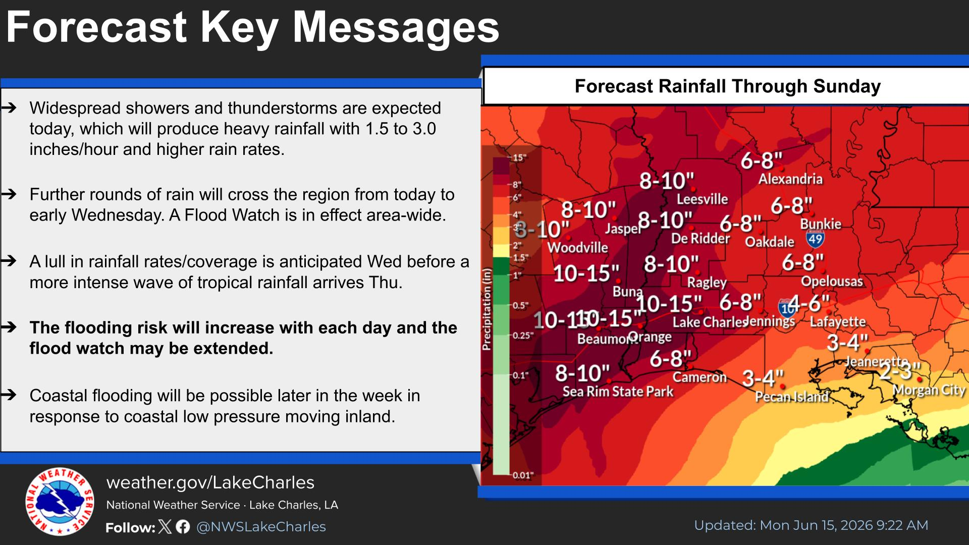
Nearly the entire state is under a flood watch as tropical moisture from a disturbance in the Gulf interacts with a stalled cold front, which is expected to produce between three to six inches of rain, with the possibility that some areas could see up to ten inches of rain fall over the next few days.
“We can have some very isolated areas in what we call training where the storms get locked in over a certain area and those thunderstorms just keep popping off in that same location,” Keim said.
Keim says Louisiana residents should be prepared for heavy rains and the possibility of flooding.
“When you have a very juiced atmosphere, with these high, high humidity levels this kind of potential exists for big-time flooding,” Keim said.
Keim says the chances for rain are high every day through Saturday. He says once this week ends, it’s likely the state will no longer be concerned with drought conditions.
“But you never want this much rain, this fast,” Keim said.
Keim says we could see the biggest rainfall totals on Tuesday going into Wednesday, but again a heavy downpour is possible every day this week, especially during the afternoon hours.
We’ve seen heavy rainfall across the I-20 corridor. In the Shreveport-Bossier area numerous cars had to be abandoned because they got stuck in flood waters.