




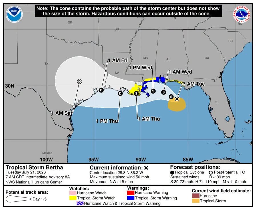
Tropical Storm Bertha is strengthening as it continues making its way towards Louisiana. As of ten this morning, Bertha’s maximum sustained winds have increased to 60 miles an hour. The eye of the storm has moved to within 70 miles south-southwest of Panama City, Florida, and it’s moving north-northwest at around three miles an hour.
National Weather Service Meteorologist Jacob Zeringue says there are two main threats that Bertha brings to the Louisiana coast:
“The biggest threat is going to be storm surge. We’ll see up to 2-4 feet of inundation on the eastern-facing shores; and then also tropical storm-force wind gusts, starting as early as Wednesday morning and lasting throughout the day on Wednesday,” Zeringue explained.
Zeringue says tropical storm-force winds are not expected to extend too far north from the coast.
“It looks like it will mainly be confined to south of the I-10 corridor; so New Orleans and points southward towards the bayou parishes have the higher likelihood of seeing those tropical storm-force wind gusts tomorrow,” Zeringue said.
Zeringue says the most important thing with this storm is, unlike Tropical Storm Arthur, Bertha is not expected to linger as it makes its way west across Louisiana towards Texas.
“Once it does start making that westward turn, we are expecting the forward speed to remain pretty solid, about 20-25 miles an hour,” Zeringue noted.