


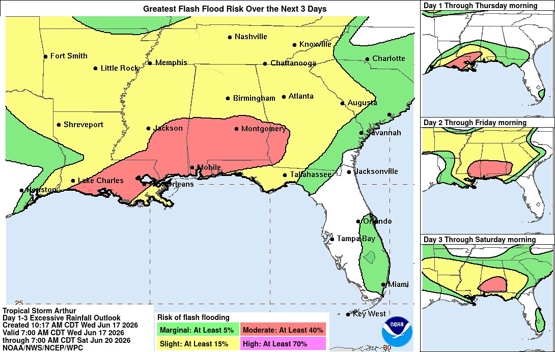
Tropical Storm Arthur, located off the Texas coast, is expected to bring flash flooding conditions to south and central Louisiana. The system was upgraded to a tropical storm this morning with sustained winds of 40 miles per hour. Andy Tingler with the National Weather Service in Lake Charles says Arthur could bring eight or more inches of rain to some areas.
“The threat, the next few days, is mostly just heavy rain. Some places, especially in urban areas, could pick up some urban flooding,” Tingler said.
Maximum winds have stayed around 40 miles per hour and are expected to drop as Arthur makes landfall. Tingler says the biggest threat from the disorganized storm is heavy rainfall in a short amount of time.
“We’re not expecting to get any stronger than what it is; so as far as wind damage or something like that, that’s really not anticipated,” Tingler noted.
The center of the storm is currently over the Texas coast, moving towards Louisiana at around nine miles per hour. Tingler says Southwest and Central Louisiana will be right in the path of the heaviest rain.
“All of the heavy rain really is confined to the south and to the east of the center. So all the heavy rain that’s currently over the Gulf will move across Louisiana, mainly tonight and into tomorrow,” Tingler explained.